ONLINE HELP
Digital assistant for TopoIndo product user(s)
__________
Links to Electronic Instrument Products
Product 1. Voltex Nova V.1
Journal Voltex Nova V.1
----------------------
Product 2. Voltex Rida V.1
Journal Voltex Rida V.1
----------------------
Product 3. Voltex Riska V.1 (under development)
Journal Voltex Rida V.1
----------------------
Product 4. Voltex Nur V.1 (under development)
Journal Voltex Nur V.1
----------------------
Product 5. Voltex Cahya V.1 (under development)
Journal Voltex Cahya V.1 (under development)
----------------------
Product 6. Voltex Ni V.1 (under development)
Journal Voltex Ni V.1 (under development) |
|
Index 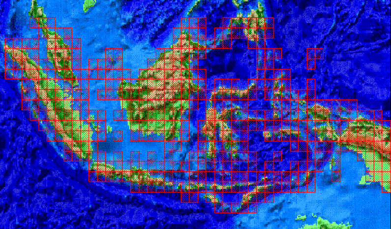
Topography is a basic aspect for surveying and mapping activities. Such as forestry, agriculture, geography, urban planning, and so on. In Indonesia (generally dominated by the sea), this aspect has been developed since hundreds of years ago ("VOC Era" in 1614). This software will provide a topographic description and simple modeling in three dimensions. Including topographic data on a scale of 1:200,000 (in the first version) and technical assistance (for 3 months), is a very low cost to bring your knowledge of Indonesian topography. The software will be developed to be able to overlap with other maps (vector and or raster), import/export, and the final mission is image processing, especially for the Indonesian region.
Data Source
- National Imagery and Mapping Agency (NIMA). This website provides free Digital Elevation Model (DEM) level 0 data at a scale of 1:250,000..
- Department of Public Works, Republic of Indonesia. This website provides free Landsat-4 and 5 satellite image data.
- National Oceanic Administration Agency (NOAA). This website provides global weather satellite data for free.
Price
Price is: USD.500 for personal use or USD 2,500 for network/office use (including tax, and courier fee). If you are interested, please send an email to eridarso@yahoo.com, and your request will be responded to..
Computer System Requirements
- Minimum
 |
Hard drive space (harddisk)
125 Mb |
|
Memory (RAM) 16
Mb |
|
Processor Pentium 75-MHz |
|
Video Memory (VRAM)
2 Mb with 3D Accelerator |
|
Mouse |
|
Port Serial |
|
Monitor resoluytion 800 x 600 pixel (full screen) |
Recommendation
|
Hard drive Space (harddisk)
250 Mb |
|
Memory (RAM) 64
Mb |
|
Processor Pentium 400-MHz
|
|
Video Memory (VRAM)
16 Mb dengan 3D Accelerator |
|
Mouse |
|
Port Serial |
|
Monitor beresolusi 800 x
600 pixel (layar penuh) |
GNSS receiver Global Positioning System (GPS)
Data cable interface data
Port RS-232
List of Receiving Compatible GPS Devices
 |
Produk-produk Lowrance :
|
GlobalNav 200, |
|
GlobalNav 212, |
|
GlobalNav 310, |
|
AirMap, |
|
GlobalMap Sport, |
|
GlobalNav Sport |
|
|
Eagle Products,
|
Eagle Expedition, |
|
Eagle Expedition II |
|
Eagle Explorer, |
|
Eagle View, |
|
AccuMap Sport, |
|
AccuTrail, |
|
AccuNav Sport, |
|
UltraNav GPS, |
|
AccuMap 12 |
|
|
All types of Garmin and Magellan products |
|
|
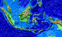
Topography of
Indonesia
Include topography data

Natural Resources Baseline Data and Modeling
Basic Data of natural resources at different scales for all regions of Indonesia |